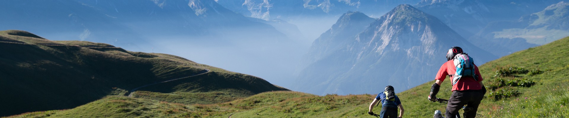
Alpine pasture tour
Planay Hiking itinerary
Route
:
BOUCLE
Daily duration (minutes)
:
180
Distance (km)
:
5.4
Route
:
500
Level bue - easy

 Departure/Arrival
 Point of interest
Circuit n° 1
Chambéranger entrance car park
- Environment :
- Mountain location
Informations
- SITRA services :
- Route
- Route 1723
- Parking :
- Car park
- SITRA services :
- Services
Download
Informations
Alpine pasture tour
Route de Chambéranger
Chamberanger
73350
Planay
Phone : +33 4 79 55 03 77
Presentation
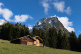
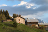
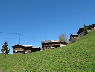
Villages of alpine pastures inhabited during the summer months : definitively a charming trail.
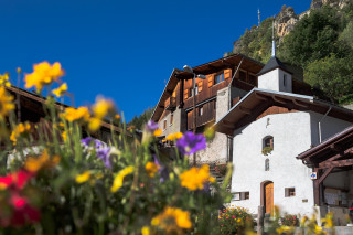
Outward route: Cross the village to Saint Barthélémy Chapel. On the right, take the path towards La Rochette/Le Mollard/Plan Fournier.
Leave the village and follow the markings across the pastures, crossing the road twice before turning left onto the path. Pass in front of the rock sheltering a statue of the Virgin Mary to reach La Rochette.
At the entrance to the hamlet, turn right onto the path leading up through the meadows. This will take you to Le Mollard. Continue following the signs for Pélapoët/Plan Fournier.
The path climbs through a forest of spruce trees before opening onto a meadow announcing Plan Fournier.
Then take the path that passes under the cross. Descend via a wide path towards La Golle.
After passing a large rock, the forest path narrows, crosses a small stream and leads to the La Golle clearing.
Leave the house on your right and descend a wider path; on the right, take a small path towards Le Mollard / La Rochette.
From there, take the same path back to Chambéranger.
Highlights of the route:
Discover charming summer villages that have retained their traditional charm, reflecting the mountain life of yesteryear and the agricultural and pastoral traditions that shaped the landscape and followed the rhythm of the seasons.
Discover Plan Fournier and its superb panorama of the Vanoise.
Security
Take the weather forecast before leaving.
Don’t forget to drink to eat and have a break.
Equipment
Equip yourself with good shoes and clothes well suited for mountains.
Carry IGN map. This map is provided for information purposes only.
Good behaviour
Stay on track.
Respect the environment .
Be careful with herds, keep your dog on leash.
Be careful with your waste, bring it back with you.
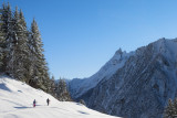
OuverturesAll year round daily.
Possible snowshoe route depending on snow conditions.
Possible snowshoe route depending on snow conditions.
To know
Topos pas à pasStart: Cross the village of Chamberanger until you reach Saint Barthélémy Chapel. On the right, take the path towards La Rochette/Le Mollard/Plan Fournier.
1/ Leave the village and follow the signs across the pastures, crossing the road twice before turning left onto the path.
2/ Pass in front of the rock sheltering a statue of the Virgin Mary to reach La Rochette.
3/ At the entrance to the hamlet, turn right onto the path leading up through the meadows.
4/ This will take you to Le Mollard. Continue following the signs for Pélapoët/Plan Fournier. The path climbs through a forest of spruce trees before opening out onto a meadow, signalling your arrival at Plan Fournier.
5/ Take the path that passes under the cross. Descend via a wide track towards La Golle. After passing a large rock, the forest path narrows, crosses a small stream and leads to the La Golle clearing.
6/ Leave the house on your right and descend a wider path; on the right, take a small path towards Le Mollard/La Rochette.
From there, take the same path as on the way up to Chambéranger.
Alerte visiteursThis hike is accessible with a dog, but we advise you to keep your dog on a lead throughout the entire route. This helps to protect wildlife, preserve flora and ensure the peace and quiet of other hikers.
Photos
Photos


Linked offer
Planay
Located between the village and the alpine pasture, on the sunny side, “les montagnettes” are really small villages temporary inhabited according ...
Planay
Chamberanger (1250m) is a typical village which is a real witness of the traditional way of life in mountain: steep little streets, chains of houses ...