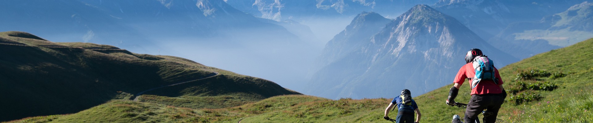
Between 2 rivers loop
Planay Hiking itinerary
Route
:
BOUCLE
Daily duration (minutes)
:
160
Distance (km)
:
6
Route
:
300
Level bue - easy

 Departure/Arrival
 Point of interest
Circuit n° 1
Hydraulica Gallery car park
- Environment :
- Mountain location
Informations
- SITRA services :
- Route
- Route 1200
- Typologie promo SITRA :
- Not recommended in bad weather
- Parking :
- Car park
- SITRA services :
- Services
Download
Informations
Between 2 rivers loop
Route de Pralognan
Le Villard
73350
Planay
Phone : +33 4 79 55 03 77
Presentation
On the secret foothills of the Dent du Villard, get into the wild: this trail will take all your athletic skills.
Outward route: cross the road towards the Pralognan power station. Cross the village to reach the stream: follow it on your left for 100 metres. Take the bridge on your right and cross the stream. The path branches off to the left into the forest, towards Planay Chef-lieu.
Follow the markings to reach the Planay valley: walk up alongside the stream to the bridge at the foot of the village. Cross it and walk up the road on your left.
When you reach the district road, cross it and take the path opposite, heading towards Le Villard on the right bank/Gorges de Ballandaz/Notre-Dame de la Salette. Leave the village and climb up to a place called Le Chesalet: pass the house and continue straight ahead. Enter the forest and descend to the departmental road. Cross it and take the path 20 metres further on your right, towards Le Villard/Gorges de Ballandaz.
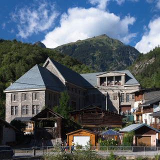
At the intersection, descend on your right towards Le Villard. You will arrive behind the town hall office/Galerie Hydraulica.
Alternative route: Departure from Le Planay; possible detour to the Ballandaz Gorges
Highlights of the route:
Discover domesticated water on this route following the hydroelectric installations that supply the power stations in Le Villard.
Follow the markings to reach the Planay valley: walk up alongside the stream to the bridge at the foot of the village. Cross it and walk up the road on your left.
When you reach the district road, cross it and take the path opposite, heading towards Le Villard on the right bank/Gorges de Ballandaz/Notre-Dame de la Salette. Leave the village and climb up to a place called Le Chesalet: pass the house and continue straight ahead. Enter the forest and descend to the departmental road. Cross it and take the path 20 metres further on your right, towards Le Villard/Gorges de Ballandaz.
At the intersection, descend on your right towards Le Villard. You will arrive behind the town hall office/Galerie Hydraulica.
Alternative route: Departure from Le Planay; possible detour to the Ballandaz Gorges
Highlights of the route:
Discover domesticated water on this route following the hydroelectric installations that supply the power stations in Le Villard.
Security
Take the weather forecast before leaving.
Don’t forget to drink to eat and have a break.
Equipment
Equip yourself with good shoes and clothes well suited for mountains.
Carry IGN map. This map is provided for information purposes only.
Good behaviour
Stay on track.
Respect the environment .
Be careful with herds, keep your dog on leash.
Be careful with your waste, bring it back with you.
OuverturesFrom 01/05 to 31/10 daily.
According to snwo conditions.
According to snwo conditions.
To know
Topos pas à pasDeparture: From the Galerie Hydraulica, cross the road towards the Pralognan power station. Cross the village to reach the stream: follow it up to your left for 100 metres.
1/ Take the bridge on your right and cross the stream. The path branches off to the left into the forest, towards Planay Chef-lieu.
Follow the markings to reach the Planay valley: follow the stream upstream to the bridge at the foot of the village. Cross it and follow the road on your left.
2/ When you reach the departmental road, cross it and take the path opposite, heading towards Le Villard on the right bank/Gorges de Ballandaz/Notre-Dame de la Salette.
3/ Leave the village and climb up to a place called Le Chesalet: pass the house and continue straight ahead. Enter the forest and descend to the departmental road. Cross it and take the path 20 m further on your right, towards Le Villard/Gorges de Ballandaz.
4/ At the intersection, descend on your right towards Le Villard.
5/ You will arrive behind the town hall office/Galerie Hydraulica.
Alerte visiteursThis hike is accessible with a dog, but we advise you to keep your dog on a lead throughout the entire route. This helps to protect wildlife, preserve flora and ensure the peace and quiet of other hikers.
Pics
Pics


Linked offer
Planay
Located at an altitude of 860 m, it’s the most important village of the municipality. Close to Bozel and on the way to go to Pralognan, this village...

Planay
Le Planay Chef-lieu (1130 m) is quite typical by the way of how it is built: with houses on both sides of the road that leads to Pralognan la ...
Useful address
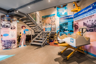
Planay
This interpretation centre, with its scenography, lets you discover all the secrets of hydroelectricity and its history, which have left their mark on...