Coomb of Raffort's loop
Feissons sur Salins Hiking itinerary
Route
:
BOUCLE
Daily duration (minutes)
:
45
Distance (km)
:
2.2
Route
:
30
Level green ?very easy

 Departure/Arrival
 Point of interest
Circuit n° 1
Town hall car park
- Environment :
- Mountain location
Informations
- SITRA services :
- Route
- Route 1290
- Parking :
- Car park
- SITRA services :
- Services
Download
Informations
Coomb of Raffort's loop
50 Rue de l'ancien four
Mairie
73350
Feissons-sur-Salins
Phone : +33 4 79 55 03 77
Presentation
Walk really easy, for everybody, even with stroller ; it will bring you within nice meadow with a nice view on 3 Valleys.
- From city hall, follow "chemin de plan Navy", then the truck road which goes through meadows.
- You will arrive in a forest where the trail going up slowly.
- At the junction, take the path that goes up to the Feissons's cross for few metres and take at the right side the track which goes back to the village.
- You will arrive in a forest where the trail going up slowly.
- At the junction, take the path that goes up to the Feissons's cross for few metres and take at the right side the track which goes back to the village.
Security
Take the weather forecast before leaving.
Don’t forget to drink to eat and have a break.
Equipment
Equip yourself with good shoes and clothes well suited for mountains.
Carry IGN map. This map is provided for information purposes only.
Good behaviour
Stay on track.
Respect the environment .
Be careful with herds, keep your dog on leash.
Be careful with your waste, bring it back with you.
OuverturesAll year round daily.
Subject to snow conditions.
Subject to snow conditions.
To know
Topos pas à pasDeparture: Feissons sur Salins in front of the town hall.
1/ Take the Plan Navy path, then the carriage road that crosses the flat meadows.
2/ You will arrive in the forest where the path climbs slightly.
3/ At the crossroads, find the path that climbs towards the Croix de Feissons, climb slightly, turn right a few metres further on and follow the path that leads back to the village.
Alerte visiteursThis hike is accessible with a dog, but we advise you to keep your dog on a lead throughout the entire route. This helps to protect wildlife, preserve flora and ensure the peace and quiet of other hikers.
Pics
Pics

Linked offer
Feissons-sur-Salins
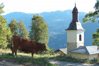
This church, with its façade broadly exposed to the sun, awaits you a little way outside the village, as if encouraging you to meditate facing the ...

Feissons-sur-Salins
Located at 1260 meters, you can find the city office, a bar/restaurant and a bed and breakfast. It is possible to visit the Saint Maurice church ...