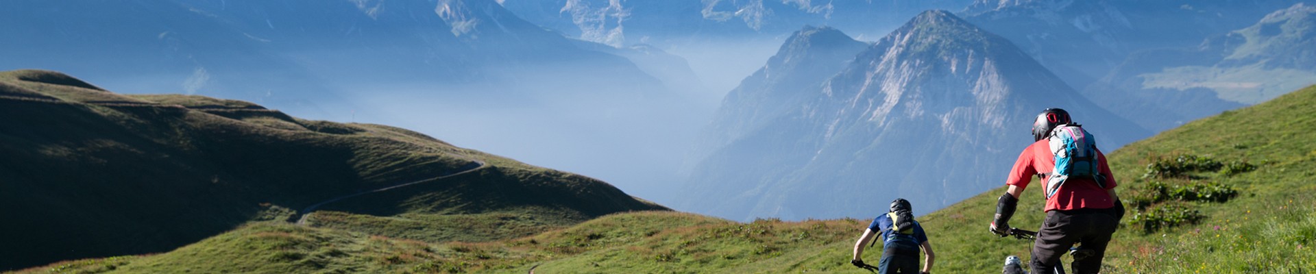
Tour of Pointe de la Vuzelle - 2-day hiking trip in an alpine environment
Planay Hiking itinerary
Route
:
BOUCLE
Daily duration (minutes)
:
450
Distance (km)
:
15.5
Route
:
1600
Wandering duration (days)
:
2
Level black - very hard

 Departure/Arrival
 Point of interest
Circuit n° 1
- Environment :
- Mountain location
Informations
- SITRA services :
- Route
- Route 2405
- Typologie promo SITRA :
- Not recommended in bad weather
- Parking :
- Car park
- Free car park
- SITRA services :
- Services
Equipments & Services
- Passages delicats :
- En juin certains ruisseaux et/ou névés peuvent être délicats à traverser en raison de la fonte des neiges, n'hésitez pas à vous renseigner au préalable auprès de la gardienne.
Informations
Tour of Pointe de la Vuzelle - 2-day hiking trip in an alpine environment
Plan Fournier
73350
Planay
Phone : +33 4 79 55 03 77
Presentation
Discover the wild and natural alpine landscape at the foot of the majestic Grand Bec. You will be amazed by the views that await you with this mountain in its purest form!
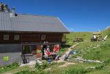
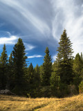
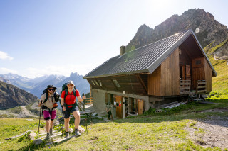
The hike starts from the alpine village of Plan Fournier, with views of the Bozel Valley in the middle of the coniferous forest. At the beginning, you will follow a path through the forest, which then leads to a valley where you will wind your way through blueberry bushes and rhododendrons. The refuge is located at the top of this valley. Once you arrive at the refuge, you will overlook the valley and enjoy a beautiful view of the Vanoise glaciers and the Pralognan valley, with a guaranteed high-mountain atmosphere. You will have the opportunity to meet the outspoken refuge warden and enjoy the delicious meals she will lovingly prepare for you!
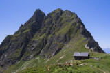
After a good night's sleep, set off for the Col de Leschaux, surrounded by rocky scenery at the foot of the Grand Bec, which towers above. The climb takes you through a beautiful glacial cirque to the Col de Leschaux, where you will enjoy a stunning view of Pralognan.
You will then continue towards Mont Chevrier, where you will find lush green vegetation, and a little further on, the Vuzelle waterfall, over 100 m high, classified in 1935. The water here is collected and channelled through tunnels to the hydroelectric power station below.
The return to Plan Fournier will be through the forest taken on the way there.
Day 1 itinerary:
From Plan Fournier (1,723 m), head towards Refuge du Grand Bec, following the marked trail throughout. Cross through the forest before climbing up the valley below La Vuzelle towards the pass of the same name to reach Refuge du Grand Bec (2,403 m).
Day 2 itinerary:
Take the path up to the Col de Leschaux. Once at the pass, take the path that descends towards Pralognan (a slightly steep path), then a little further down, take the path that climbs back up towards Mont Chevrier. Head towards the Vuzelle waterfall, then rejoin the path you took on the way up the day before.
Please note: In June, some streams and/or snowfields may be difficult to cross due to snowmelt, so please check with the park ranger beforehand.
This hike is for experienced walkers, as there are some fairly steep sections along the way.
Access:
By car from Moûtiers, head towards Pralognan. Once you have passed through the village of Le Planay, take the small road on your left towards Chambéranger. Continue along this road, following signs for Plan Fournier (1,723 m), a hamlet where you can park.
OuverturesFrom 24/06 to 11/09 daily.
Subject to favorable weather.
Subject to favorable weather.
To know
Topos pas à pasDeparture: Plan Fournier car park (1,723 m)
1/ DAY 1: from ‘Plan Fournier’ to ‘Refuge du Grand Bec’ / Duration: 2½ hours / Elevation gain: +680 m / From the Plan Fournier departure sign (1,723 m), head towards Refuge du Grand Bec, following the marked trail throughout. Cross through the forest before climbing up the valley below La Vuzelle towards the pass of the same name to reach Refuge du Grand Bec (2,403 m).
2/ DAY 2: from the ‘Refuge du Grand Bec’ to the Col de Leschaux Mont Chevrier– Plan Fournier/ Duration: 5 hours / Elevation gain: + 740 m and - 1380 m / Take the path up to the Col de Leschaux. Once at the pass, take the path that descends towards Pralognan (a slightly steep path), then a little further down, take the path that climbs back up towards Mont Chevrier. Head towards the Vuzelle waterfall, then rejoin the path you took on the way up the day before.
Pics
Pics


Linked offer
Located at the start
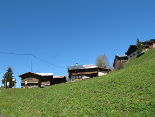
Planay
Located between the village and the alpine pasture, on the sunny side, “les montagnettes” are really small villages temporary inhabited according ...
Useful address
Planay
Back to basics: a warm and friendly, rustic, and peaceful atmosphere. Easy access: breathtaking views of the surrounding valleys, magical sunsets, and...