Grand Bec Refuge return


Presentation
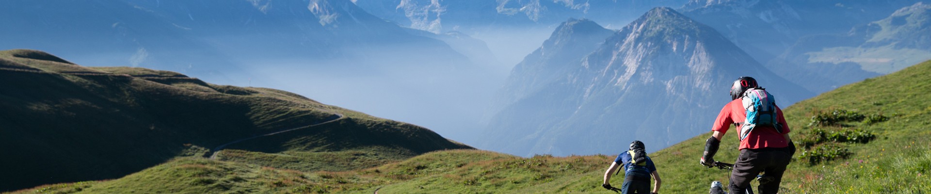
Definitively the Lord of the valley ! Perfect trail to discover landscapes and alpine pastures way of life. Take a break and enjoy a night at Grand Bec refuge. For mountain beginners, return trip to the refuge.
How to go:
After Planay village take the road on the left in the direction of Chamberanger. Before Chamberanger, take the road at the right side which reaches Plan Fournier (1723m) where you can find a small parking with some places.
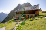
At the gate of the Vanoise national Park, in a beautiful place, a small refuge sits at the bottom of the Vuzelle’s peak, with a nice view on the Grand Bec Mountain, on the Vallonet peak and on the Chavière valley.
This walk is easy to reach with children, parents, grand-parents, walkers or mountain climber.
To go up:
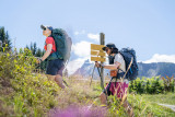
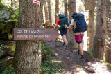
You will find a sign at the beginning in Plan Fournier; follow the direction of the Grand Bec refuge. Footpath and sign are clearly visible. Crossing the forest, and then going up through a comb under the Vuzelle and the same name pass. This way to go up has a really nice view on the valley of Bozel, the Lauziere Massif and the Vanoise Massif.
NB: In June, certain streams and/or névés can be tricky to cross because of the melting snow, so don't hesitate to ask the warden at the Refuge du Grand Bec beforehand.
After Planay village take the road on the left in the direction of Chamberanger. Before Chamberanger, take the road at the right side which reaches Plan Fournier (1723m) where you can find a small parking with some places.
At the gate of the Vanoise national Park, in a beautiful place, a small refuge sits at the bottom of the Vuzelle’s peak, with a nice view on the Grand Bec Mountain, on the Vallonet peak and on the Chavière valley.
This walk is easy to reach with children, parents, grand-parents, walkers or mountain climber.
To go up:
You will find a sign at the beginning in Plan Fournier; follow the direction of the Grand Bec refuge. Footpath and sign are clearly visible. Crossing the forest, and then going up through a comb under the Vuzelle and the same name pass. This way to go up has a really nice view on the valley of Bozel, the Lauziere Massif and the Vanoise Massif.
NB: In June, certain streams and/or névés can be tricky to cross because of the melting snow, so don't hesitate to ask the warden at the Refuge du Grand Bec beforehand.
Security
Take the weather forecast before leaving.
Don’t forget to drink to eat and have a break.
Equipment
Equip yourself with good shoes and clothes well suited for mountains.
Carry IGN map. This map is provided for information purposes only.
Good behaviour
Stay on track.
Respect the environment .
Be careful with herds, keep your dog on leash.
Be careful with your waste, bring it back with you.
OuverturesFrom 15/06 to 30/09 daily.
Depending on snow condition
Please note that outside this period, the footbridge on the route is dismantled.
Depending on snow condition
Please note that outside this period, the footbridge on the route is dismantled.
To know
Alerte visiteursThis hike is accessible with a dog, but we advise you to keep your dog on a lead throughout the entire route. This helps to protect wildlife, preserve flora and ensure the peace and quiet of other hikers.
Topos pas à pas0/ Plan Fournier 1,723 m
1/ At the crossroads, take the path on the right 1,750 m
2/ At the crossroads, take the path on the right 1,812 m
3/ Continue along the path on the mountainside 1,850 m
4/ Take the path that climbs to the left 1,950 m
5/ Grand Bec refuge 2403 m
6/ Take the same path to go down.
1/ At the crossroads, take the path on the right 1,750 m
2/ At the crossroads, take the path on the right 1,812 m
3/ Continue along the path on the mountainside 1,850 m
4/ Take the path that climbs to the left 1,950 m
5/ Grand Bec refuge 2403 m
6/ Take the same path to go down.
Download
Informations
- Levels of sporting experience :
- Level red – hard
- SITRA services :
- Route Aller / Retour
- Elevation (m) 680
- Daily duration (minutes) 300
- Route 680
- Route 2405
- Sections :
- Sport
- Services :
- Pets welcome
- Pedestrian sports :
- Pedestrian sports
- Hiking itinerary
Equipments & Services
- Parking :
- Car park
Informations
Grand Bec Refuge return
Route de Plan Fournier
Parking de Plan Fournier
73350
Planay
Phone : +33 4 79 55 03 77

Destination
Refuge du Grand Bec en Aller-Retour
Route de Plan Fournier
Parking de Plan Fournier
73350
Planay
GPS coordinates
Latitude : 45.4314
Longitude : 6.711041
On the road towards Pralognan la Vanoise, take the road to Chambéranger, on the left going up after the village of Planay, and on the right going down from Pralognan la Vanoise.
Once in Chambéranger, take the mountain road towards Plan Fournier. Once in Plan Fournier, follow the signs (yellow signs) towards the Refuge du Grand Bec.
Once in Chambéranger, take the mountain road towards Plan Fournier. Once in Plan Fournier, follow the signs (yellow signs) towards the Refuge du Grand Bec.
- Environment :
- Mountain location
Prices
Free access.